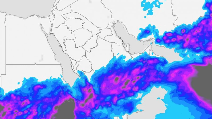
Yemen | A rainy condition is considered the most comprehensive and extensive since the beginning of summer, bringing heavy rains in the coming days
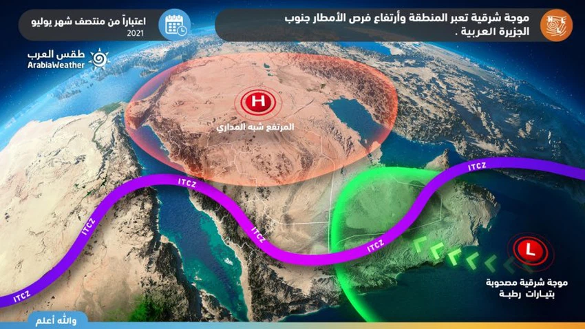
Weather of Arabia - It is expected that an upper wave will rush towards the southern parts of the Arabian Peninsula, coinciding with the deepening of the air-thermal depression located in the southeast of the Kingdom of Saudi Arabia, to deviate the tropical separator line over southern Arabia remarkably, pushing with it large amounts of tropical moisture on the various layers of the atmosphere, Which leads to the emergence of a state of atmospheric instability accompanied by thunderstorms in many areas, God willing.
Large parts of Yemen will be affected by the rainy condition
In the details, the first weather disturbances, God willing, begin on Monday/Tuesday night on parts of the coasts and heights of Hadramawt and Shabwah, to expand the rains on Wednesday and gradually intensify during the weekend. , with the possibility of formation of water bodies, while it is expected that rains will extend to coastal areas and be of moderate intensity in general.

With the intensification of the rainy situation at the end of the week, it is expected that the rains will cover all regions of Yemen, including the coastal areas, and these rains will be of varying intensity in general with their intensity at times, accompanied by showers of cold, and the activity of surface winds that raise dust and dust in some areas, in addition to Major disturbance in the coastal areas bordering the Arabian Sea.
Arab Weather advises to pay attention to the dangers of sudden torrential rains when thunderstorms fall, especially in valleys and cliffs, and to pay attention to the risk of lightning and severe thunderstorms by taking shelter inside buildings, and finally a warning to sea-goers and navigation practitioners of the danger of going to the sea due to the wave height of more than four meters.
The scientific reason behind the formation of the rainy state
The reason for the formation of the situation is also due to the rush of an eastern wave towards the region, which means the movement of winds in the high layers from the eastern side to the west, accompanied by the presence of large amounts of moisture and high heat load in the various active layers of the atmosphere, coinciding with the deepening of the atmospheric thermal depression located in the southeast of the Kingdom. Saudi Arabia, which significantly deviates the orbital separator line over southern Arabia.

It is worth noting that during the summer in the northern hemisphere the trade winds move northward and take a zigzag path, carrying with them large amounts of moisture from the tropics, towards areas with average solar radiation in large values, which creates a fertile area for the formation of cumulus clouds that cause For thunderstorms, or what is locally called monsoon rains.
Arabia Weather App
Download the app to receive weather notifications and more..


